

Shirley MacKenzie invented, designed and drew the cover for The Hippies Who Meant It
She has the ability to enter a book and look at whatever the author was writing about as if looking over his shoulder. Because her uncanny skill had made the illustrated edition of The Laughing Princess a delight, I simply asked her if she would do the cover. The result exceeded all my well-founded expectations. Mary Montague, who prepared the MS for print, also wrapped the picture around the cover, and inserted “Joe’s Map”.
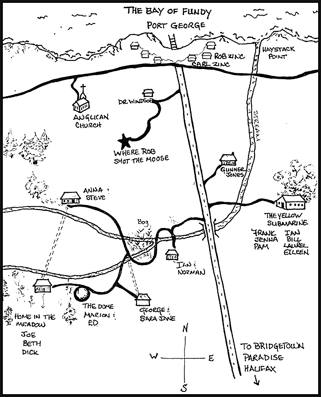 The setting of The Hippies Who Meant It is overlaid on reality. The North Mountain exists, as does the Bay of Fundy, the Village of Paradise, Bridgetown, Halifax and the main roads that connect them. However, the detail is imaginary, so please don’t go looking for the Home in the Meadow, Anna’s house or Haystack Point. If you want to know where Joe, Beth and Dick live, and where it is in relation to their friends and neighbours, believe in Joe’s map while you’re reading. When you go to the North Mountain, enjoy the reality around you for the magical place it is.
There is a do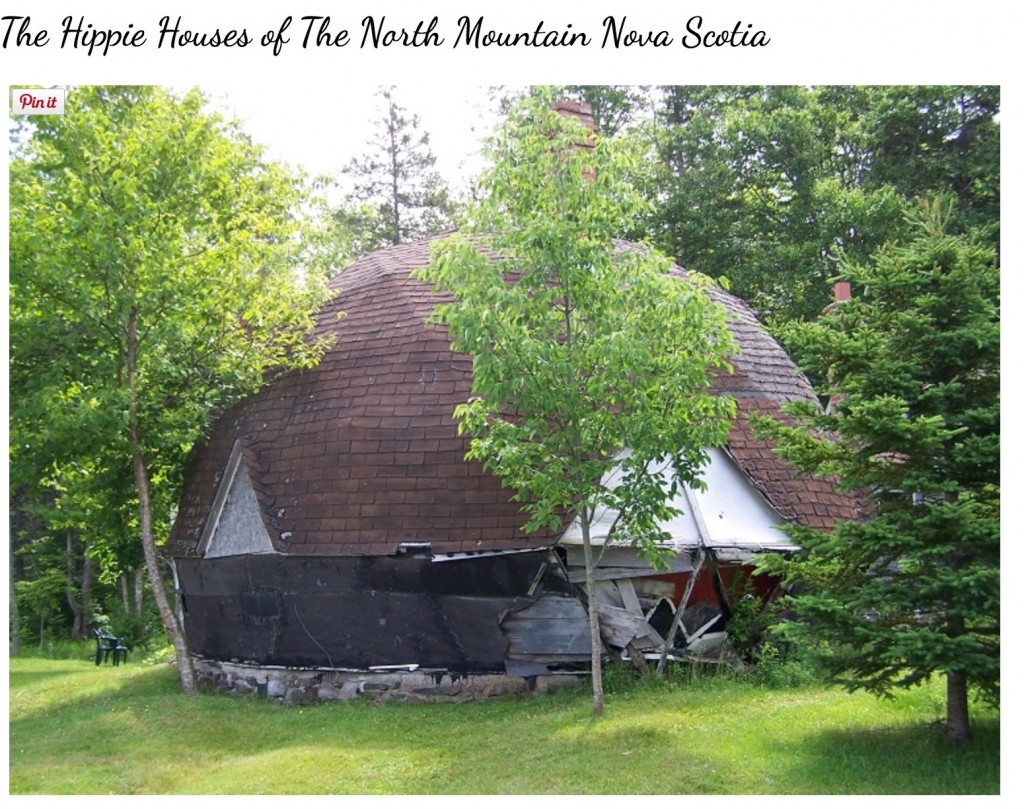 me in the story that looks like one that is now falling into disrepair. Don’t try to visit it: it’s on private property, and is so dangerous that it may soon be pulled down. The photo below is one of several you will find on GypsyYaya.com. here.
And for another retro moment: identify the following sixties peopl.


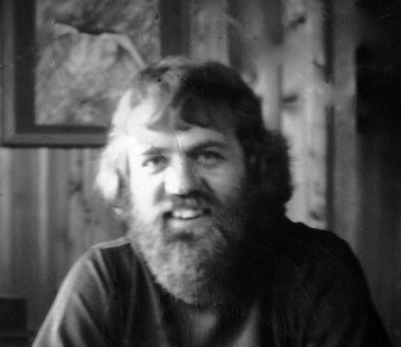

Simon & Garfunkel, Bob Dylan, Paul McCartney, Gordon Lightfoot, Keith Richards, Oh My God, it’s Seymour! Peter Paul & Mary.
Hi Seymour!
I’m currently reading your book The Hippies Who Meant it, and I live where the Dome used to be. Our woodshed was the attached portion to the dome. The dome was taken down by the man who built the home we now live in. We are fascinated and enthralled by the history here and I was so excited to find out about your book. We are a couple of modern day hippies ourselves. There are some oddities in your “map” that do and don’t make sense. The house in the meadow, perhaps that was across the brook, a woman lives there now, she is a bit of a legend up here. The map shows port George at the bottom but I’m quite sure that’s supposed to be Hampton. Port George is quite a bit east up mount Hanley way. Would love to connect and share current photos as the remaining part of the dome now serving as a shed is being well maintained, it still has those signature cutouts along the roofline and the chimney may be crumbling but it stands. We put new shingles and new floor in since we’ve been here, we came up over 5 years ago now. There is definitely a magic and energy here and there are no shortage of good vibes, lots of gardening, plenty of learning, reading nude in the sun, and a little of the other hippy things…wink wink. I am only a short way into your book but was hoping to find the links to the old photos of the dome, the link on your page now directs to a gambling page. I know there were a few photos but cannot seem to find them, all but the one on your main page. If you’re ever up visiting the area, would love to have you up to visit!